Lake Titicaca Guide: Where It Is, Altitude, Islands and Travel
At 3,812 m between Peru and Bolivia. Getting to Puno from Cusco, the Uros, Taquile and Amantaní, how many days, altitude and Candelaria in February.
Lake Titicaca lies at 3,812 m (12,507 ft) on the high plateau that Peru shares with Bolivia, and covers roughly 8,400 to 8,560 km², depending on the source, with its deepest point near 280 m. On the Peruvian side the gateway is the city of Puno: a full day overland from Cusco, crossing La Raya pass at 4,335 m, or a flight of about 1 hour 40 minutes from Lima to Juliaca plus some 40 minutes by road. The classic visit is one day on the water, from about 7:30 a.m. to 4:00 p.m., to the Uros floating reed islands and to Taquile, whose textile art UNESCO has listed since 2008.
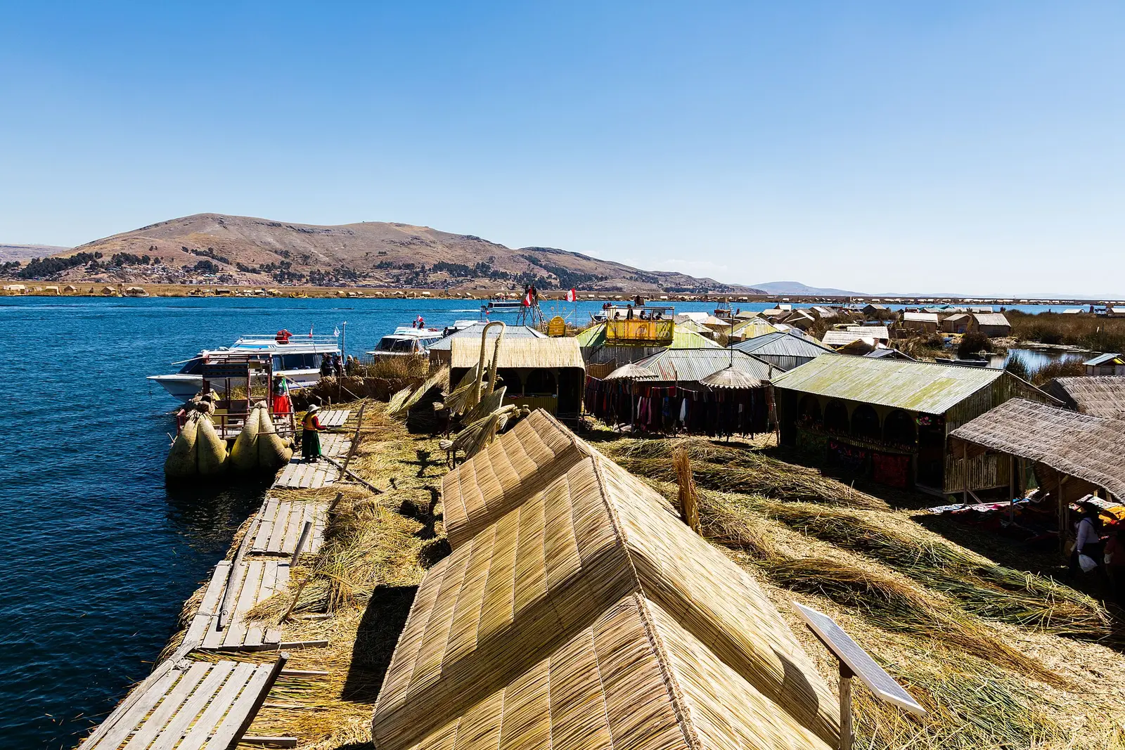
One of the Uros floating islands near Puno. The ground underfoot, the reed boats and the thatched roofs are totora; the motor launches bring visitors from Puno. Photo: Diego Delso, CC BY-SA 4.0
The short version
- Where: on the border of Peru and Bolivia, around 15°50'S, 69°30'W. About 56% of the surface is Peruvian and 44% Bolivian.
- Altitude: 3,812 m (12,507 ft), the figure the CDC uses for travelers. Higher than Cusco, so plan your acclimatization.
- Gateway city: Puno, on the lake shore. Juliaca airport is about 40 minutes away by road.
- From Cusco: a full day by tourist bus or by PeruRail's Titicaca train, or about 7 hours on an overnight bus.
- Main visit: a full-day boat trip to the Uros floating islands and Taquile Island.
- Protected area: part of the lake is the Titicaca National Reserve (36,180 ha, created in 1978), and the whole Peruvian sector is a Ramsar wetland of international importance.
- Time needed: two nights in Puno is the practical minimum.
Where is Lake Titicaca?
Titicaca sits on the altiplano, the high plateau between the eastern and western ranges of the Andes, in the far south of Peru. The Peruvian shore belongs to the Puno region; the rest of the lake belongs to Bolivia. The Ramsar Convention places the center of the Peruvian sector at 15°50'S, 69°30'W.
Bolivia's meteorological service gives 8,562 km², with 56% on the Peruvian side, a maximum depth of about 281 m and an average depth of 107 m. The Binational Lake Titicaca Authority, the body Peru and Bolivia set up to manage the basin together, uses slightly smaller figures in its own presentations: 8,400 km², a maximum length of 170 km and a maximum depth of 272 m.
It has two basins, a large northern one and a small southern one, joined by the narrow Strait of Tiquina in Bolivia. PromPerú, Peru's tourism board, calls it the highest navigable lake in the world, and you will hear that line on every boat.
Lake Titicaca facts at a glance
| Fact | Figure | Source |
|---|---|---|
| Altitude | 3,812 m (12,507 ft) | CDC Yellow Book |
| Surface | 8,400 to 8,562 km² | ALT / SENAMHI Bolivia |
| Share in Peru | about 56% | SENAMHI Bolivia |
| Maximum depth | 272 to 281 m | ALT / SENAMHI Bolivia |
| Titicaca National Reserve | 36,180 ha, created 31 October 1978 | Supreme Decree 185-78-AA |
| Ramsar site (Peruvian sector) | 460,000 ha, designated 20 January 1997 | Ramsar Convention |
The Titicaca National Reserve protects reed beds and wetlands in two sectors, Puno (29,150 ha) and Ramis (7,030 ha). Its totora reed is the raw material of the floating islands.
How to get to Lake Titicaca
| Route | Time | What you see |
|---|---|---|
| Cusco to Puno, tourist bus (Route of the Sun) | about 9 hours, 6:30 a.m. to about 6:00 p.m. | Andahuaylillas church, Raqchi, lunch in Sicuani, La Raya pass at 4,335 m, Pukara museum |
| Cusco to Puno, PeruRail Titicaca train | about a full day | La Raya at 4,335 m, the high point of the line |
| Cusco to Puno, overnight bus | about 7 hours, arriving around 5:00 a.m. | Nothing: you sleep |
| Lima to Juliaca, flight | about 1 hour 40 minutes | Then about 40 minutes by road to Puno |
The Route of the Sun bus is how several of our Peru and Bolivia programs do it. It stops at the painted church of Andahuaylillas, known as the Sistine Chapel of the Americas, and at Raqchi, the Inca temple of the god Wiracocha, so the drive becomes a sightseeing day rather than dead time.
PeruRail's Titicaca train is the slow, comfortable option, running in both directions. The Belmond Andean Explorer, a luxury sleeper train, also links Cusco, Puno and Arequipa. The overnight bus saves a hotel night but lands you tired at a higher altitude. Flights land in Juliaca, since Puno has no airport of its own.
If you are coming all the way from the coast, our guide on getting from Lima to Cusco compares flights and overland routes, and the Cusco, Sacred Valley and Lake Titicaca itinerary shows how to fit all three into one trip.
The islands: Uros, Taquile and Amantaní
Uros floating islands
The Uros islands are man-made platforms of totora reed, anchored in the shallow reed beds close to Puno. The boat ride from the port is short. You step off onto ground that gives slightly underfoot, like a thick mattress. Families show how the islands are built from blocks of reed roots topped with fresh layers of cut reed. Expect to be offered a ride in a reed boat and textiles for sale: both are how the islanders earn from the visits.
Taquile Island
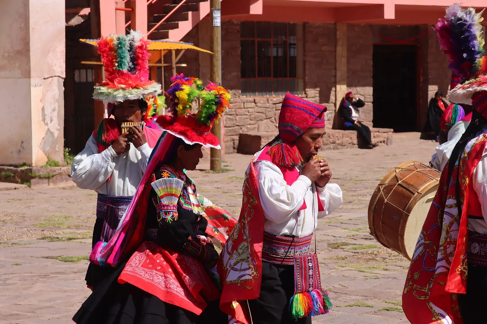
Musicians in the main square of Taquile. Look at the woven belts and the knitted caps: the textile work UNESCO recognizes is worn every day. Photo: Draceane, CC BY-SA 4.0
Taquile is a real island of rock and terraces, farther out on the lake. UNESCO inscribed "Taquile and its textile art" on the Representative List of the Intangible Cultural Heritage of Humanity in 2008, after proclaiming it a masterpiece in 2005. On Taquile both men and women weave, and they do it every day. Look for two pieces UNESCO singles out: the chullo, a knitted cap with earflaps, and the calendar belt, which records the community's ritual and farming cycle. The island also runs its own school of crafts to pass the techniques on.
The visit means walking up stone paths from the dock, slow work at this altitude.
Amantaní Island
Amantaní is where you go to stay the night. On our Aymara programs, travelers sleep and eat with a local family, and in the late afternoon climb the sacred hill of Pachatata for a ceremony of thanks. The sunset from the hilltop is the reason many people choose it.
| Island | What it is | Best for | Time |
|---|---|---|---|
| Uros | Floating reed islands near Puno | Seeing how the reed islands are built | First stop of the lake day |
| Taquile | Rocky island, UNESCO-listed textile tradition | Textiles, views, a walk | Second stop of the lake day |
| Amantaní | Rocky island with family homestays | An overnight stay, Pachatata hill at sunset | Overnight |
How many days do you need?
Two nights in Puno is what most travelers need: arrive on day one, spend day two on the lake, leave on day three. On our programs the Uros and Taquile day starts with breakfast and a transfer to the port at about 7:30 a.m. and ends back in Puno around 4:00 p.m.
Three nights lets you add a day on land. Our Aymara Route tour, from US$127 per person, leaves Puno at 8:00 a.m. and follows the southern shore: the Inka Uyo temple in Chucuito, the funerary towers of Molloco, the ancient Waru Waru raised fields, the carved rock of Amaru Muru and the colonial churches of Juli, known as the Little Rome of the Americas. You are back in Puno around 5:00 p.m.
Add Bolivia if you have the time. The main border crossings on the lake are Desaguadero and Kasani, both in Puno. Our Peru and Bolivia tours combine both sides; check the rules for your passport in our Peru entry requirements for US citizens guide.
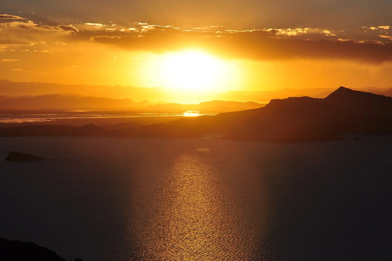
Sunset over the lake from Amantaní, the island where visitors stay overnight with local families. Photo: Richard from Leeds, Yorkshire, UK, CC BY 2.0
Altitude: Titicaca is higher than Cusco
At 3,812 m, the lake is about 400 m higher than Cusco, and the road from Cusco climbs to 4,335 m at La Raya. Flying from Lima to Juliaca takes you from sea level to the altiplano with no time to adjust.
The CDC lists Lake Titicaca among Peru's high-altitude destinations and recommends a gradual ascent, with acetazolamide as an option for travelers at risk; ask your doctor before the trip. In practice:
- Go to Titicaca after Cusco, not before.
- Take the first afternoon in Puno slowly: walk, drink water, eat light.
- Pace yourself on Taquile. The climb from the dock is where most people feel the altitude.
- Know the warning signs. Our guide to Cusco altitude and acclimatization explains which symptoms mean you should go down.
Best time to visit Lake Titicaca
The altiplano follows the same rhythm as Cusco: a wet season in the southern summer and a dry season in the southern winter. SENAMHI, Peru's weather service, records almost no rain in Puno in July; its July bulletins note accumulations as small as 0.1 mm. Dry months bring the clearest skies; in every season the sun is intense and the wind on the boat is cold. Our Peru packing list covers layers, sun protection and what to wear on the water. For a month-by-month view of southern Peru, see the best time to visit Machu Picchu.
The Candelaria festival in February
Every February, Puno hosts the Festivity of the Virgen de la Candelaria, which UNESCO added to its Intangible Cultural Heritage list on 27 November 2014. The main religious day is 2 February, with a solemn mass and a procession of the Virgin through the city. Around it come two dance contests and a street parade. In 2026 the native dance contest ran on 31 January and 1 February, the contest of glittering "trajes de luces" costumes on 8 February and the octave parade on 9 and 10 February. Expect diablada, morenada and caporales, book Puno hotels early and check the new program each year.
Practical tips for the lake
- Fees: the national reserve and the island communities charge visitors. On an organized tour ask whether these are included; on ours, your guide tells you before you board. We could not confirm a current official amount.
- Cash: carry small bills in soles for crafts, a reed boat ride or a drink on the islands. Our guide to money and tipping in Peru explains what to carry.
- Safety: the usual city precautions apply in Puno and Juliaca. Our guide to safety in Peru has the details.
Frequently asked questions
Where is Lake Titicaca? On the border of Peru and Bolivia, on the Andean altiplano in southern Peru. About 56% of the lake is Peruvian, and the main Peruvian city on its shore is Puno.
How high is Lake Titicaca? 3,812 m (12,507 ft) above sea level, according to the CDC. That is about 400 m higher than Cusco.
How big is Lake Titicaca? Between about 8,400 and 8,562 km², depending on the source, with a maximum depth of 272 to 281 m.
How do you get from Cusco to Lake Titicaca? By tourist bus along the Route of the Sun (about 9 hours with stops), by PeruRail's Titicaca train (about a full day) or by overnight bus (about 7 hours) to Puno.
How many days do you need at Lake Titicaca? Two nights in Puno cover the classic Uros and Taquile day. Add a night for the Aymara Route or a homestay on Amantaní.
What are the Uros floating islands made of? Totora reed. The base is made of blocks of reed roots, topped with layers of cut reed that the islanders renew over time.
Is Lake Titicaca worth visiting? Yes, if you have at least two extra days after Cusco. It adds a different landscape and living island cultures, including Taquile, whose textile art is on UNESCO's heritage list.
Visit Lake Titicaca with us
At Viajes Cusco Perú, the Cusco tour operator behind this blog, we build Titicaca into complete trips. The Peru and Bolivia tour in 10 days, from US$1,817, goes from Machu Picchu by night bus to Puno for a full lake day with the Uros and Taquile, then on to La Paz and the Uyuni salt flat; the 14-day version, from US$3,247, takes the Route of the Sun instead. For the lake with a spiritual focus, the Aymara Baptism tour from Cusco to Puno in 5 days, from US$917, includes a night with a family on Amantaní. The complete Peru tour in 15 days, from US$2,084, takes the Route of the Sun bus between Puno and Cusco. Already in Puno? Join our Aymara Route day tour. See all our Andes tours and, for the bigger picture, the best things to do in Peru.
Altitude, area, depth, protected-area data, UNESCO listings and travel times checked on October 15, 2026, against the CDC Yellow Book page for Peru, SENAMHI Bolivia, the Binational Lake Titicaca Authority, the Ramsar Sites Information Service, Supreme Decree 185-78-AA, UNESCO's Intangible Heritage lists, PeruRail, PromPerú and reports by Andina, Peru's state news agency.